As far back as I can remember having a child, we, either Mom, Carl and I or Mom, Ava and I, traveled around north Georgia to the various Native American Festivals absorbing their heritage (multi-tribal events are coolest), cultures, customs and regalia.
As in most traditions, Mom initiated them and Dad happily participated if it involved taking Carl. Dad loved to see what that kid would say or do with new environments. One year when Carl was about seven, Dad and Mom took Carl and me to the Cherokee Reservation in Cherokee, North Carolina. My father’s mother, who lived in Palm Springs, California at that time, sent Carl a full Native American costume with headdress and all for his birthday. It only was fitting for Carl to insist on wearing it to see his relatives. My blue-eyed blonde son was sure even at an early age that he was a Native of this land. He was if only in spirit.
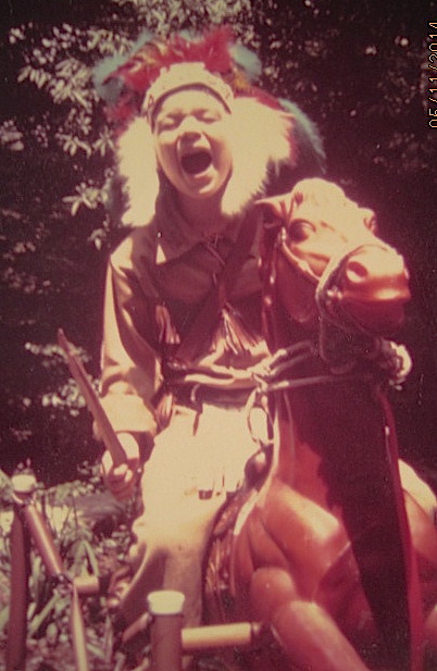
Carl on the war path circa 1973!
He had also gotten that year this amazing horse with some of the finest springs made! He literally bounced on it all over Mom’s front yard! Notice his feet are not on the posts but down in bareback riding posture! All I had to do was tell him that’s how the real Indians rode their horses and that was that!
As Mom, Dad, Carl outfitted as above and I walked up the pathway to the village, there was an elderly tribesman sitting on a blanket. His face firm as if carved from wood. His eyes staring ahead as if he were blind. Without hesitation, Carl slowly folded up mimicking the position of the elder, leaned toward the man and whispered, “I’m an Indian, too!”
We adults held our breath knowing protocol normally wouldn’t allow such a spacial invasion but Carl was different. He was charismatic, magical and sent his energy ahead of him to the elder. We waited as the two enjoyed their visit and Carl was ready for the next part of his adventure.
It was fifteen years after Carl was missing before he came to me in a dream and guided me to find him. A few months later, Ava insisted on us going to a medium, Candice. When she channeled Carl, it was pretty remarkable. So much so that she told Carl she wanted to work with him from now on because he was such a great energy. He revealed that after he died, he wandered around his body for a few days near Indian Springs, Ga. and it was the Indians who came to him and guided him on his journey on the other side.
Carl had already told us years ago through the medium Candice that he had ascended to the fifth and had to get permission to go back down to the fourth to communicate with us. That he was now known as the “Great Warrior” and that the three of us (me, Carl and Ava) would write a book of that name telling the world the great truth and how there is no shame in it. Carl said that I was known there as “Woman with Great Knowledge” and that I had access to the Akashic Records. I’ve often wondered what that great truth might be. I’m thinking I might just have a clue now!
There’s so much more but this blog is about yesterday’s journey.
The minute Ava was old enough to go, we attended many Native American Festivals up until she moved to Vegas in late 2008. She and I both preferred the Rolling Thunder Mother’s Day event that has been in Canton, Ga for the past decade or so. The last Festival she and I attended was the year she left for Vegas (2008) for our Mother’s Day celebration. It was our thing. There, I bought her a feather hair thingie.
It was all those memories that bubbled like soda as I pondered how I was going to spend this Mother’s Day. I was reminded of how much fun we’d had at the one in Canton and determined that was just exactly what I was going to do. I announced to friends and family that I needed drum healing. I could hear them calling to me…healing my soul.
As I drove alone to Canton yesterday, I wished I’d brought something of Ava’s with me appropriate for the event. I looked in my rear view mirror and there it was…those feathers, bundled together with leather strips…tendrils of her hair still tangled in the design of the ornament as if they were meant to be there from its creation.
I then remembered that I keep Carl’s red, white and blue marble and Ava’s hair clip in my truck. I couldn’t wait for the next red light! I attached her feather ornament to the clip, put it in my hair and tucked Carl’s marble into my pocket. Suddenly, I felt better about my solo journey of release, healing and connecting…not really celebrating.
As I walked alone from the car to the facility, I spoke to Ava asking if she was with me. I really wanted to be holding her hand or have our arms locked around each other walking in unison as we always did. I felt a pressure in my right hand…a weight as if she had put her hand there. As soon as I acknowledged it, she affirmed it to be her. She held my hand for about ten steps or so until my mind wandered off considering the terrain and at least ten other things.
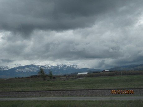
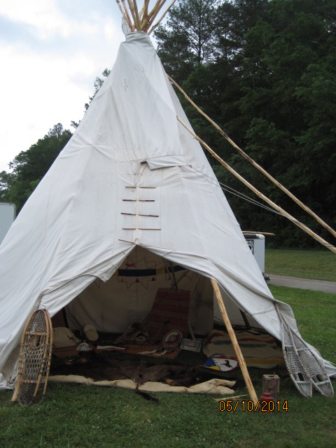
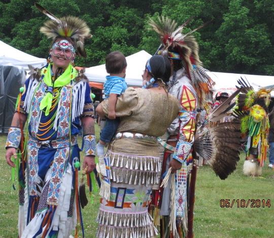
Shored by the mornings affirmations and confident Montana was safe at home, I made my rounds inside the circle of venders inhaling the fresh, clean, cool air and making note of which vender was a regular and taking an overall account of their offerings. Unfortunately for me, there were no surprises in the first half but I was sure not to be disappointed as I walked toward the area you can normally find the educational section in the rear. This is where you can learn most about that person’s tribal customs and see daily chores performed in yesteryear ways.

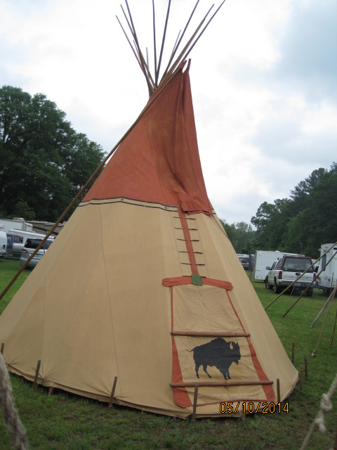
Teepee where these historians reside during the Festival

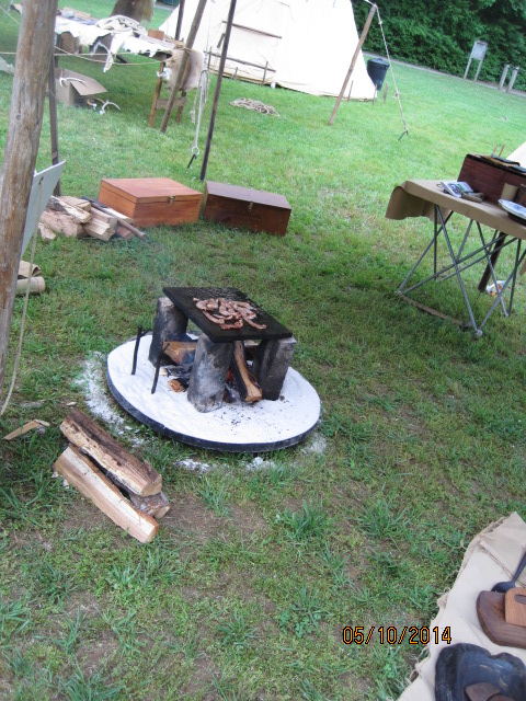
Outdoor primitive cooking for sure!
The first area was how to skin and cure hides. Interesting as it was, I was hungry therefore drawn toward the man cooking.


The MC announced the calling for the celebration to begin. The rhythm of the drums prepared me for the wonderful events to unfold as I came back around full circle. where I found a dear friend, Fred, who owns Prairie Trails in Helen, GA. Look closely at Fred’s famous hat! Go check out his store online at http://helenga.org/business/prairie-trails and support local enterprises including http://www.avascorner.org as he has several pieces of my Native American jewelry for sale to help support Ava’s Corner, Inc.!

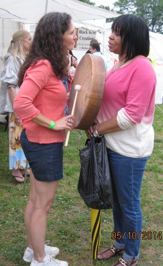
I always enjoy catching up with Fred and seeing his crazy hat! He told me that many of his longtime local suppliers had all closed and that he was struggling to keep going as well. We know that story to be repeated in the Historic Clayton, Georgia area near where I live as well. that he introduced me to Karen. I was about to leave when he became insistent for me to wait for him to introduce me to this young woman he’d just met. Her name is Kaaren Renee Robb, Founder, Host & Sound Clinician…”Growing a community of people dedicated to advocating for, participating in and spreading the good news about sound & music healing.”
This young woman held up her drum and started singing. If my eyes were closed, I would insist it was Ava singing. Ava had actually tried various creative vocalizations one of which happened to be chanting into a drum ten years ago! WOW! Of course, I started sobbing and told Karen about Ava. She asked if she could do a drum/music healing on my heart. That would be a YES PLEASE in loud internal screams! After all, I’d announced I was coming for drum healing, right? Really? How much more on point can you get than that?
I stood still, eyes closed, hands down as she sang and tapped the drum starting in my heart region. I felt the vibrations as she moved around me. It was so very familiar…a deja vous experience so much like the hundreds I had throughout 2012 after Ava’s passing.
Karen Robb, Founder, Music City Alliance for Sound & Music Healing performing healing on our new friend who channels from the other side!

Me after my sound/music healing with new friends.
The other woman is a channel for the other side who proceeded to tell me that Ava had been tired of the struggling on this side and wanted to accelerate her process to ascend to the fourth dimension. She said we would meet again on the fifth and that Ava had a surprise for me for Mother’s Day.
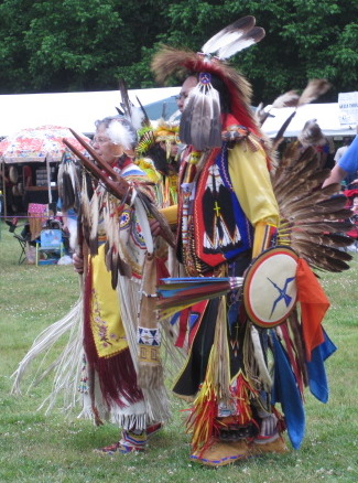
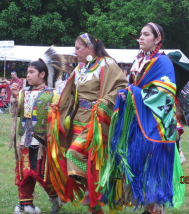
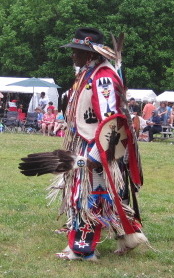
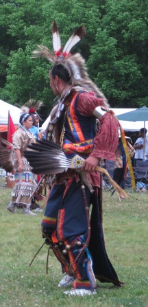
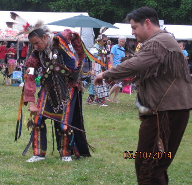
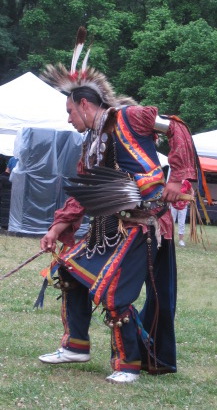
As I turned toward the inner circle where the dancers performed, I found I walked with greater peace. The drumming was renewed and the dancers (my favorite part) were in full regalia!

I had my favorites. The young woman in red teaching her daughter how to shawl dance was magical!


Happy Mother’s Day to those mamas out there who follow this Warrior Eagle Donna Mama as one of my chirren has named me on this site. There’s so much more to come!
Happy Trails (or, if trials, remember to surf the tsunami)!